|
WAVERTREE SOCIETY Home Page Woodcroft Park HOME PAGE |
||
|
WOODCROFT PARK |
||
|
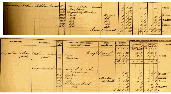
(Above): Extracts from the Schedule accompanying the Wavertree Tithe Map of 1846, showing the land parcels and properties owned by 'Serjeantson & others'. |
||

|
|
||
|
|
||