|
WAVERTREE SOCIETY Home Page Woodcroft Park HOME PAGE |
||
|
WOODCROFT PARK |
||
|
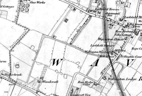
Without further evidence, it isn't possible to say with certainty where Woodcroft Park was situated. The wording of the lease points to the site between Bagot Street and what became Egerton Road - an area of land that today includes Woodcroft Road. But why would this have been described as "a minute's walk from Wavertree Station"? And how could football or other sporting fixtures have taken place on it in the late 1890s, given that by this time it was entirely covered by terraced housing? |
||
|
(Above): An extract from the Ordnance Survey Six-inch map, Lancashire Sheet 106 (1851 edition, surveyed 1845-49, new railways and docks inserted to 1864). The boundary of the Woodcroft Estate is clearly indicated. |
||
|
|
||
|
|
||