|
A point on the west side of Salisbury Road, 8 yards north of the Smithdown Road junction, was historically the meeting point of three townships: Wavertree, Toxteth Park and West Derby. The Wavertree/West Derby boundary originally followed the line of a stream, a tributary of the River Jordan which entered the Mersey at Otterspool. The curved shape of Webster Road at its southern end reflects this alignment. The posts and stones which defined the boundary - including a series of metal posts across the south-eastern corner of Wavertree (Botanic) Park - have long since disappeared, as has the stream (which is now culverted).
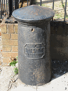
From Wavertree Park, the Wavertree/West Derby boundary ran in a broadly easterly direction. For part of its length it followed the line of Binns Road. One of the cast-iron boundary posts (pictured top right) - a round pillar with 'Township of Wavertree' on the front and 'Erected by the Overseers 1868' on the top - has survived outside No.259 Binns Road, at the end of a public footpath running through to Edge Lane. The wording is a reminder of one of the most significant aspects of the boundary; it determined which Overseers of the Poor (West Derby or Wavertree) would be responsible for assisting destitute residents.
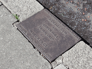
From Binns Road the township boundary continued towards the Rocket. It just touches the south side of Edge Lane Drive, as indicated by a cast-iron plate (pictured right) set into the kerb outside No.110.
|
|


