|
|
|
|
|
|
|
|
|
|
|
|
|
|
|
|
|
|
|
|
|
NEWS FROM THE WAVERTREE SOCIETY (Apr.2021):
|
|
|
|
|
|
|
|
|
|
|
|
|
|
Spotlight on . . . WAVERTREE GRANGE
Part 1 (continued from previous page)
|
|
|
|
|
|
|
|
|
|
|

|
|
|
|
|
|
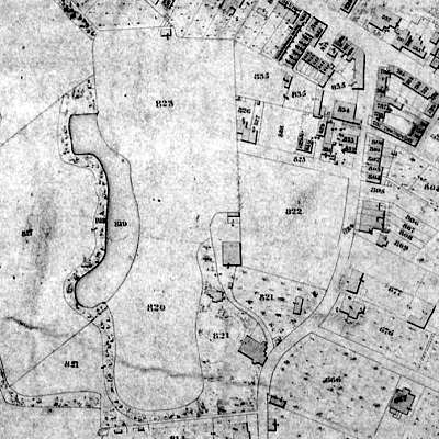
Left: An extract from the Wavertree Tithe Map of 1845-6.
The High Street is in the top right-hand corner, and Hunters Lane Congregational Church is in the bottom right-hand corner of the map.
Prince Alfred Road (then called Cow Lane) runs from north to south, and The Grange is Plot 821.
|
|
|
|
|
|
|
|
|
|
|
|
|
|
|
|
|
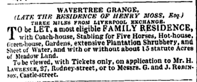
Right: The advertisement in the Liverpool Mercury, 15 June 1832
|
|
|
|
|
|

|
|
|
|
|
|
|
|
|
|
|
|
|
Right: The advertisement in the Liverpool Mercury, 28 March 1848
|
|
|
|
|
|

|
|
|
|
|
|
|
|
|
|
|
|
|
|

|
|

|
|
|
|
|
|
|
|
|
You can also help us by registering with Easyfundraising.org.uk and generating donations from retailers (at no cost to yourself) when you shop online.
|
|
|
|
|
|
|
|
|
|
|
|
|
|
|
|
|
|
|
|
|
|
|
|
|
|
Page created 12 Apr 2021 by MRC, last updated 29 Jul 2021
|
|
|
|
|
|
|
|


