|
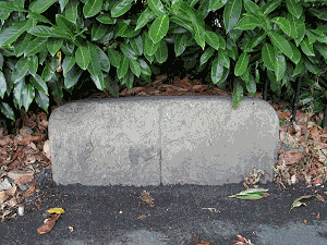
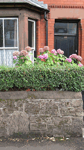
Between the Calderstones Park entrance and the Rose Lane railway bridge, the Wavertree/Allerton boundary followed Calderstones Road, Beech Lane, Green Lane and Rose Lane - the only complication being a section from Calderstones Road to Beech Lane (now part of Menlove Avenue) along property boundaries from which the markers have now disappeared. The surviving stones - e.g. in Green Lane (pictured right) and Rose Lane (pictured below) - do not indicate the township boundary as such. The boundary ran along the middle of Green Lane and Rose Lane, and the stones indicate the points at which responsibility for highway maintenance passed from one township to the next. Before this was agreed, there were inevitably arguments over the condition of the road surface, as each of the relevant authorities was reluctant to spend money repairing 'their half' of the road, knowing that travellers had the option of riding or driving on the other side! By making one of the townships (Wavertree, Allerton or Garston) responsible for the whole width of the road, such disputes could be avoided.
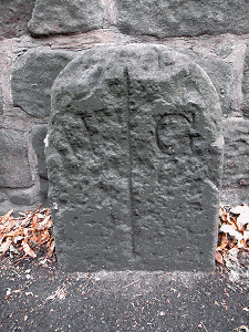
In the case of Rose Lane, it was decided that Wavertree should be entirely responsible for repairing the section between (present-day) No.26 and 'Clearview', and Allerton or Garston should be responsible for repairing the remaining sections. Hence the 'A/W' and 'W/G' stones built into the sandstone wall on the south side. Between Rose Lane and Victoria Road, the Wavertree/Garston boundary diverged from the road through the grounds of the former 'Carnatic Hall' (Mossley Hill House) but the historic markers have now - as far as we know - disappeared. There is a surviving 'G/W' stone - the letters now almost illegible - near the bus shelter outside the Aigburth House flats in Victoria Road.
|
|


